


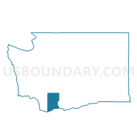
Carson Creek Voting District, Skamania County, Washington
About
Outline

Summary
| Unique Area Identifier | 688446 |
| Name | Carson Creek Voting District |
| County | Skamania County |
| State | Washington |
| Area (square miles) | 7.63 |
| Land Area (square miles) | 7.63 |
| Water Area (square miles) | 0.00 |
| % of Land Area | 100.00 |
| % of Water Area | 0.00 |
| Latitude of the Internal Point | 45.76569730 |
| Longtitude of the Internal Point | -121.88007180 |
Maps


Graphs
Select a template below for downloading or customizing gragh for Carson Creek Voting District, Skamania County, Washington


Neighbors
Neighoring Voting District (by Name) Neighboring Voting District on the Map
- Hot Springs North Voting District, Skamania County, WA
- Nelson Creek Voting District, Skamania County, WA
- Rock Creek Voting District, Skamania County, WA
- Shake Mill Voting District, Skamania County, WA
- Sprague Landing Voting District, Skamania County, WA
- Stabler Voting District, Skamania County, WA
- Wind River Voting District, Skamania County, WA
Top 10 Neighboring County Subdivision (by Population) Neighboring County Subdivision on the Map
Top 10 Neighboring Place (by Population) Neighboring Place on the Map
Top 10 Neighboring Unified School District (by Population) Neighboring Unified School District on the Map
Top 10 Neighboring State Legislative District Lower Chamber (by Population) Neighboring State Legislative District Lower Chamber on the Map
Top 10 Neighboring State Legislative District Upper Chamber (by Population) Neighboring State Legislative District Upper Chamber on the Map
Top 10 Neighboring 111th Congressional District (by Population) Neighboring 111th Congressional District on the Map
Top 10 Neighboring Census Tract (by Population) Neighboring Census Tract on the Map
- Census Tract 9505, Skamania County, WA (2,460)
- Census Tract 9504, Skamania County, WA (2,234)
- Census Tract 9503, Skamania County, WA (2,010)